SECTION VIEW · CONCOURSE L2
FAILURE 01
Robots fall down stairs
Autonomous machines relying on outdated maps walk into stairwells, drop-offs and hoardings that didn't exist when the map was made.
Transforming complex physical infrastructure into a living, self-predicting ecosystem for autonomous agents, fleets, and humans.
people a day move through spaces our model already sees. Roughly the population of a mid-sized country.
journeys a year through mapped venues
venues mapped and live
of airport terminal alone, about 24 football pitches
closures needed to capture any of it
Captured with ordinary phones during normal operations. No closures, no laser rigs.
Deep World Model is the first real-time 3D world model for complex physical infrastructure: a single, living spatial layer that robots, emergency teams and people can all query, trust and act on at the same time.
That silence has a cost, and robots, responders and travellers are the ones who pay it.
Autonomous machines relying on outdated maps walk into stairwells, drop-offs and hoardings that didn't exist when the map was made.
No emergency operations center on Earth runs on a live 3D model. Complex incidents are still coordinated from static floor plans and screen shares.
A step-free route calculated this morning can be wrong by this afternoon, the moment a lift goes down or a corridor gets rerouted.
The single largest cause of indoor autonomous failure is a map that no longer matches the building, and until now nobody had solved it.
AI evolved from conversational reasoning to real-world action. Real actions always happen somewhere physical.
Robot and sensor costs fell exponentially, while indoor spatial ground truth stayed slow and prohibitively expensive.
Most human and economic activity happens indoors. Google Maps, Apple Maps and GPS all stop at the doorway.
Every robot vendor builds a brittle, isolated map. Operators are left carrying competing, rapidly ageing spatial silos.
Fly through each site in full HD, then open its interactive model.
The real-time 3D world model for complex physical infrastructure.
Fuses ambient Wi-Fi, BLE and geomagnetic signals with vision, dramatically reducing hallucination.
The generative engine updates altered spaces in minutes, with zero full-building rescans.
Captured with mobile devices and crowd input. No downtime, no laser rigs.
The same living world model powers every use case. No separate systems, no separate maps.
When terminal spaces change, DWM updates only the modified micro-zones, in minutes. No full-building rescans.
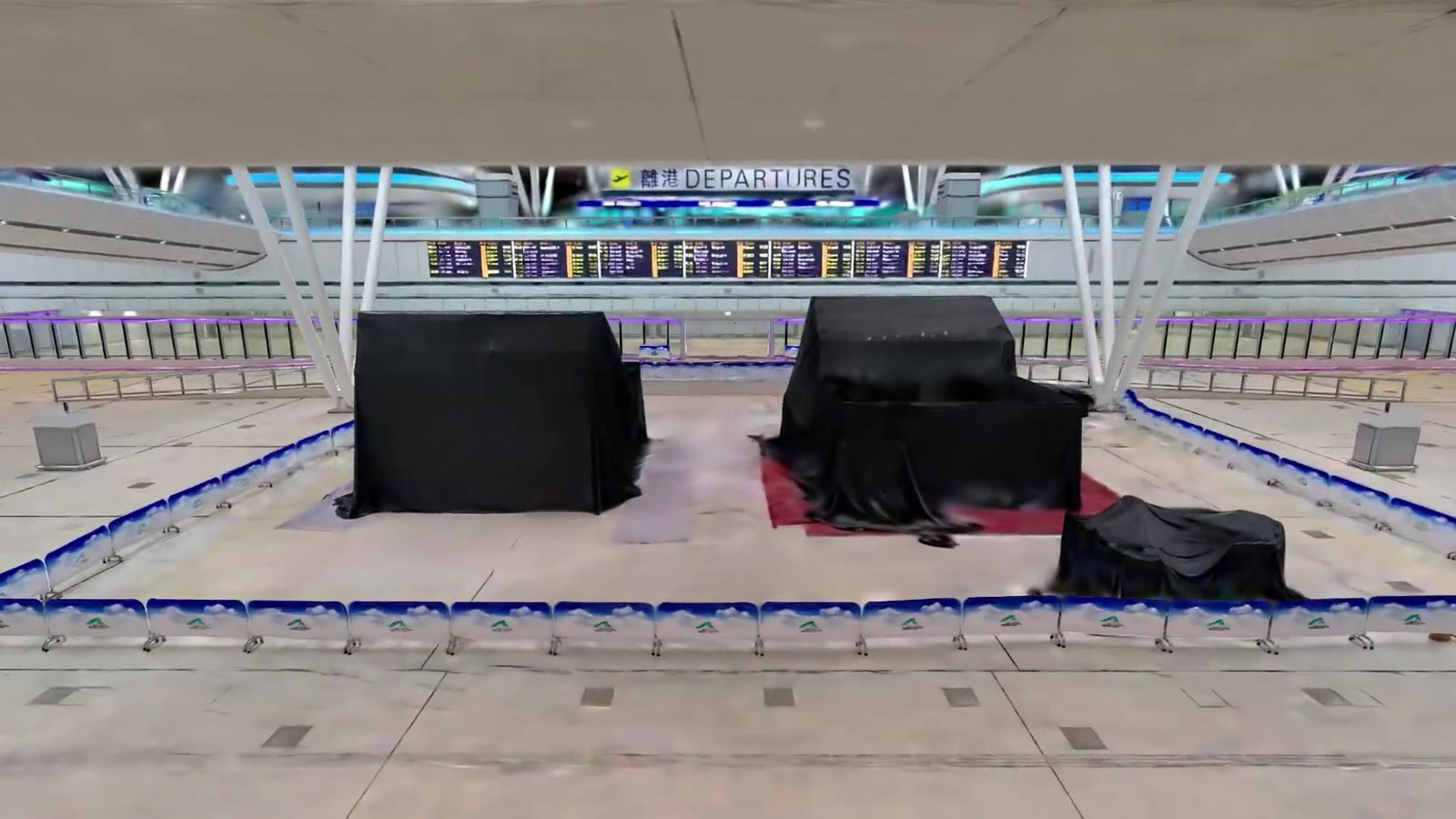
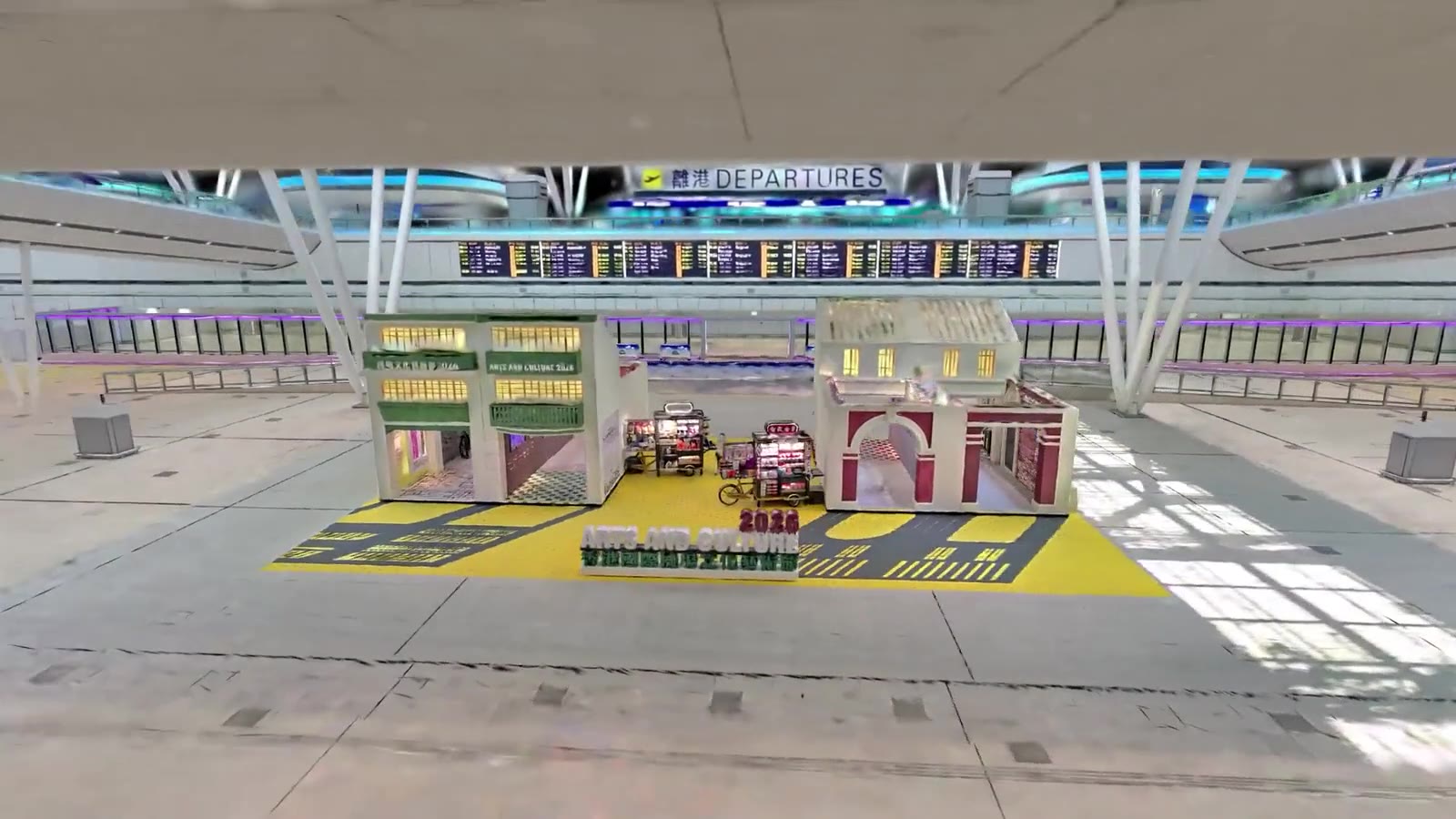 BEFORE · HOARDINGAFTER · REGENERATED
Partial-zone updates touch only altered micro-areas (retail fit-outs, hoardings, pop-ups) using ordinary mobile or CCTV feeds.
A generative neural pipeline processes local geometry changes in minutes, with zero operational footprint or floor closures.
Pushes updated 3D ground truth to connected C2 consoles and multi-vendor autonomous fleets at the same time.
Traditional digital twins cost $100,000 and take 3 weeks to rescan a terminal section. DWM self-heals in minutes from a mobile device.
A shared foundational backbone carries universal physics and geometry. Custom semantic heads provide domain-specific mastery.
We are not building one world model. We are building a world model that already knows what kind of building it is looking at.
End-to-end, from raw mobile-device data to a queryable, machine-readable 3D world.
Geometry detail in priority zones (5 cm semantics). Set per zone: low-priority areas can be coarser, up to about 1 m.
For 170,000 m²: 3h passive capture plus 6h neural reconstruction.
Base classes plus domain extensions.
Micro-zone regeneration. Only modified zones are recomputed and broadcast.
LeaveHomeSafe downloads, Hong Kong's citywide contact-tracing system
Integrated resorts on the Cotai Strip with indoor navigation, from The Venetian® to The St. Regis Macao
MTR stations with inclusive in-station navigation
A team of 20+ specialists across signal processing, graph neural networks, machine learning, location intelligence and generative AI. Full-stack builders in spatial computing, semantic AI and enterprise infrastructure, with massive-scale deployments behind us.
Connecting physical reality to the next generation of artificial intelligence, automated fleets and autonomous agents.